From Cornwall to the Isle of Wight, England’s natural beauties have always been appreciated by tourists and locals.
Even less-visited areas, such as the Howardian Hills and Dedham Vale, are acclaimed by people passing by.
The country has a lot of impressive sights of mountains and meadows, cliffs and caves, and waterfalls.
But one of England’s wonders’ most attractive features is its national trails.
So, if you want to walk around England on foot, here are some of the best trails.
The Cleveland Way
The Cleveland Way is a notorious trail in North Yorkshire. It starts in Helmsley and ends in Filey Brigg, expanding on a length of 109 miles (175 km). The path may not be fit for beginners as it has some steep climbs and knee-shattering areas that can tire you since completing the trial takes around nine days.
The Cleveland Way is famous for the rich and varied landscape it provides, as well as its historical importance.
You’ll walk around the Helmsley Castle, the White Horse of Kilburn and the Gisborough Priory.
The best time to complete this trail is between late August and early September, as there are fewer weather inconveniences.
Following the road is easy, with plenty of signs around, but having a map or GPS with you is always recommended.
The Cotswold Way
The Cotswold Way is located in Gloucestershire County from South West England.
The road starts from the Chipping Campden and goes 102 miles (164 km) to Bath in Somerset.
The recommended time for completing it is from seven to ten days so that you can fully enjoy the beautiful sights.
The Cotswold Way is great for anyone who’s reasonably fit, although there are more steep climbs around the area than other trails.
Depending on what you want to see, you must visit England in certain periods.
For example, during the winter, you can see Cotswolds clear views better, whereas, between late spring and early summer, you’ll be amazed by the woodland and grassland flourishing.
If you’re looking for areas to let your car, you can search for the closest parking areas with Parkos and book a place to secure your vehicle beforehand.
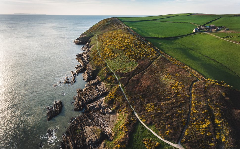
The England Coast Path
The trail of England Coast Path follows the coast of England, hence its name.
Only some parts of the course are accessible, but in the near future, people can walk the entire trail on foot as a national project aims to create the longest coastal walking route in the world.
The sections open to the public are the following:
- Skegness to Mablethorpe
- Filey Brigg to Newport Bridge
- Newport Bridge to North Gare
- North Gare to South Bents
- South Bents to Amble
- Amble to Bamburgh
Although the path is open all year round, you need to check before travelling and ensure no restrictions and diversions, such as weather concerns, will hinder your walk.
The best seasons to walk the England Coast Path are late spring and early autumn when the weather is mild, and weather conditions are proper.
There are places where you can leave your car here, too.
If you plan on extending your stay, you can look for parking at Stansted nearby for a cheap deal and a range of parking providers.
The Glyndŵr’s Way
The Glyndŵr’s path is located in Wales, and it lengthens around 135 miles (217 km) from Knighton to Welshpool.
The course might be more challenging to tackle as it’s very hilly and has interesting valley drops and ascending hills.
In some places, crossing the way can be rough, and if you’re unlucky to walk on a misty day, you’ll need a compass for guidance.
The Glyndŵr is quite varied but most walkers can complete it in around ten days.
However, you need to take it easy and not underestimate the path.
Luckily, many guest houses and campsites can be found along the road, so you can find support and a place to regain strength if you’re struggling with finishing the route.
Exploring the trail is best during summer, despite the hot climate, because of the breath-taking sights.
Hadrian’s Wall Path
Hadrian’s Wall Path is for you if you’re looking for a truly life-changing walking experience.
Located in the north of England, the road runs over 84 miles (135 km), starting from Wallsend and ending in Bowness-on-Solway.
The path is known as a UNESCO World Heritage Site for its rolling fields and fascinating museums along the way and was built by Emperor Hadrian the Second.
The recommended direction is from east to west in the direction the wall was built.
Most of the path is easy to walk by almost anyone, but there’s a short section of the road where you need to be professionally prepared, as there are many short climbs and descents between Chollerford and Birdoswald.
Some of the highlights of the wall include the following:
- Roman Forts of Segedunum
- River Tyne bridges
- Solway salt marshes
- Housesteads and Birdoswald
It takes around six to seven days to complete the trail if you’re an experienced walker, but it might take longer to explore the surroundings fully.
The recommended time to visit is between May and October when the weather is proper, the ground is dry, and the erosion risk is reduced.
At the same time, the tide might affect some parts of the trail, so choose your travel time carefully.